John Ogilby Map 'The Extended Road from Oakham to Richmond'
This item is now sold.


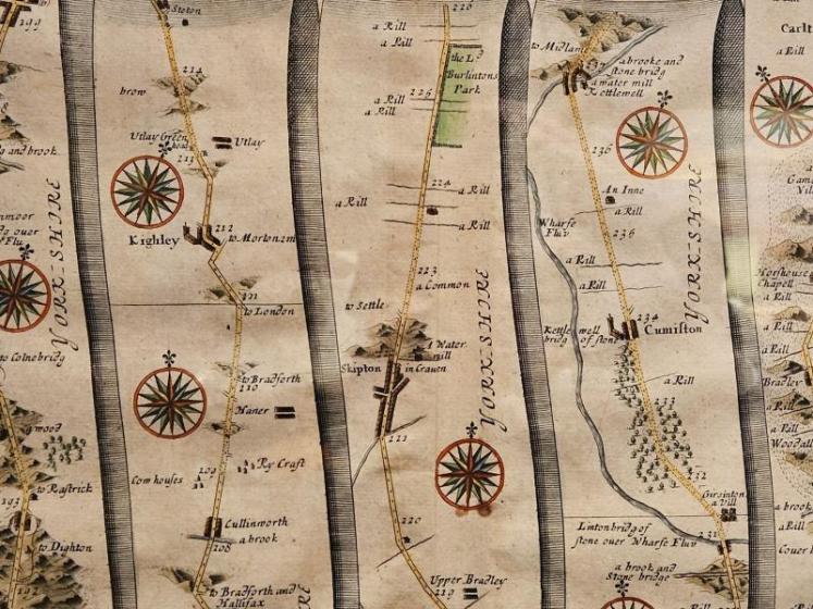


John Ogilby Map 'The Extended Road from Oakham to Richmond'
A print from a strip map of "The Extended Road from Oakham to Richmond," created by John Ogilby in 1675, c.1800. It is part of the first comprehensive road atlas of England and Wales entitled "Britannia". The original map was engraved on copper plates to allow intricate detail to be added before printing. The map is composed of multiple vertical strips, each representing a segment of the road with detailed illustrations of key landmarks, which is typical of Ogilby's work. This map covers the road from Barnsley to Richmond (Yorkshire), detailing the route t...hrough several notable cities such as Halifax. More information on this series of maps can be found on the David Rumsey Map Collection website - click here. Measures 26.5" wide x 23.5" high including frame. Stock number CS371.
Stock number CS371


Showrooms with Inspirational Displays
Be inspired by our showrooms with a variety of room settings. Every item we sell is carefully selected by the proprietor, Peter Sturman. His eye for quality and originality ensures that beautiful, usable antiques are always available: for the traditional collector, or as statement pieces for contemporary interiors.
Location
Main Street, Hawes, North Yorkshire, DL8 3QW
Opening Hours
Monday to Saturday 10am - 5pm and Sunday 11am - 4pm